
The Enroll America website has interactive state maps that show the distribution of the estimated number of uninsured residents ages 0-64 in each state:
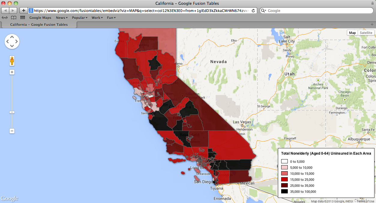
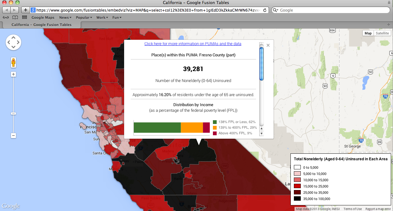
There also are county maps that show the estimated number and percentage of adults ages 0-64 who are uninsured (and their income levels, either below 138% Federal poverty level and eligible for expanded Medicaid, or between 139% and 400% Federal poverty level and eligible for subsidies in the health insurance exchanges):
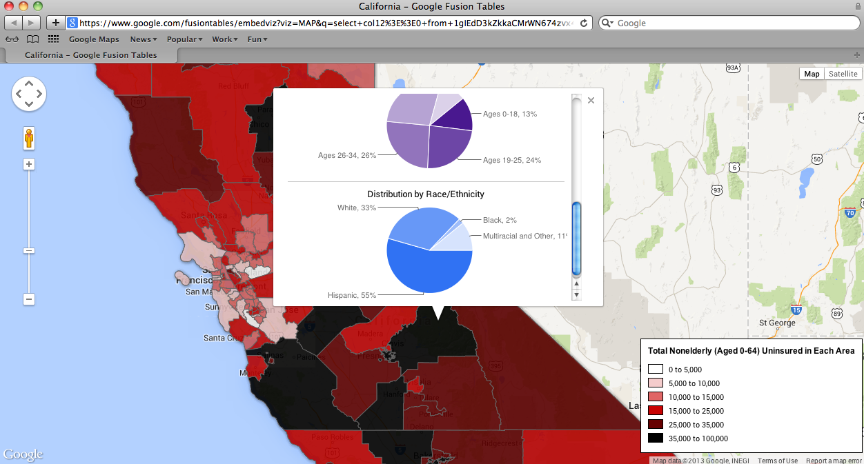
The county level maps also show the ages, and the race and ethnicity of the estimated number of uninsured residents in each county:
These maps will be especially useful for prioritizing and optimizing outreach, education, and engagement activities as the open enrollment period for the state and federal health insurance exchanges begins on October 1, 2013.
The data for the maps were developed by the Centers for Medicare & Medicaid Services and the Department of Health and Human Services Office of Assistant Secretary for Planning and Evaluation, based on 2011 American Community Survey data.
